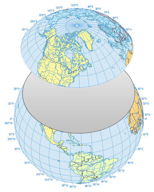
Why do you fly over Greenland in an airplane flight?
Or why is it that when you see flight paths on a map they always take a curved route between 2 cities?It’s because planes travel along the shortest route in a 3-dimensional space.
This route is called a geodesic or great circle route. They are common in navigation, sailing, and aviation.
But geodesics can be confusing when you’re looking at a 2-dimensional map as they follow quite the odd flight path. Let’s dig into this concept a bit deeper.
Great Circle Routes Explained
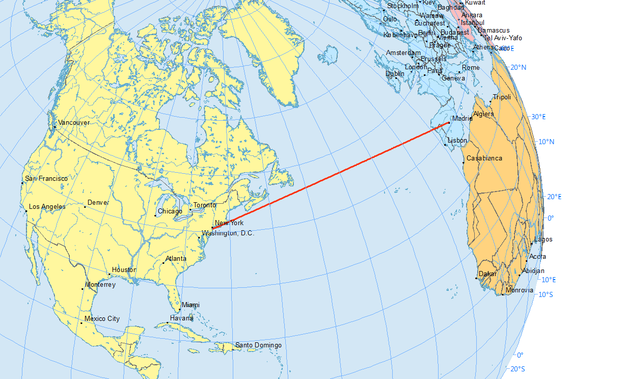
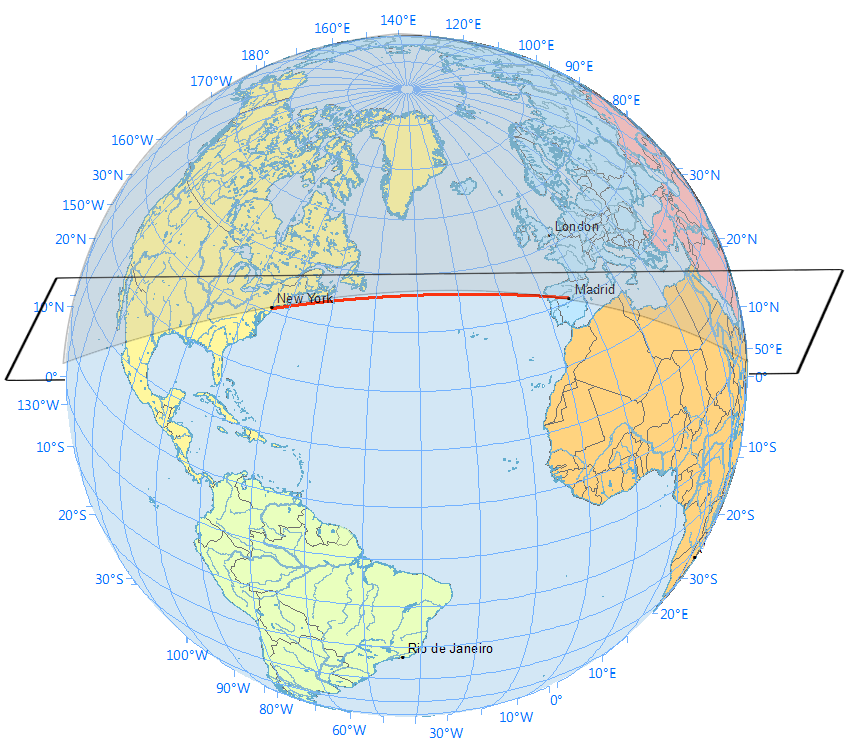
In a flight path from New York to Madrid, if I asked you which line is shorter, you’d say the straight one, right?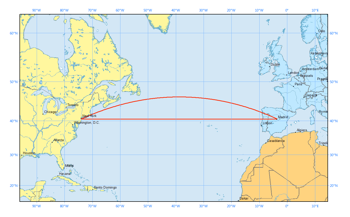
This is why flight paths travel along an arc between an origin and a destination.
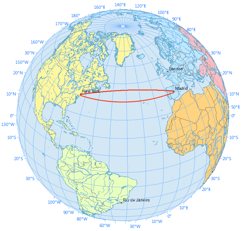
Now here’s what the same flight paths look like on a sphere. Remember that the straight line in the Mercator map above followed the 40° latitude line.
The takeaway is this: a route that looks longer on the map is because of the distortion created by map projections like the Mercator Projection.
In navigation, pilots often use great circles (geodesic) as the shortest distance flight.
Great circles vs small circles
Now that you have a visual understanding of great circles. Here’s a definition of what a great circle is:- A great circle is a circle on the globe such that the plane passing through the sphere’s center is equal to the circumference of the Earth.
- Alternatively, a great circle is where the radius is equal to that of the globe representing the shortest distance between two points on the surface of the earth.
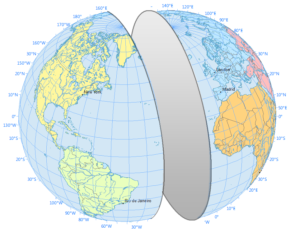
In basic terms, imagine you’re cutting into an orange. You can cut them at any angle – north-south, east-west, diagonally. As long as you cut two identical portions, then the circle where the cut was made is a great circle.
For example, the equator is a great circle because it’s the maximum possible circle:
A great circle generates two arcs with the shorter one being the shortest path. Here is the shortest path and how the plane is angled to create the shortest path.
While a rhumb line track is at a constant azimuth, a geodesic line changes direction all the time.
This fundamental difference in navigation concepts can have a significant impact on long-distance sea voyages.
How Geodesics Work
Planes travel along the shortest route in 3-dimensional space. This route is called a geodesic or great circle.While map projections distort these routes confusing passengers, the great circle path is the shortest path between two far locations.
This is why pilots fly polar routes saving time and distance. And this is why pilots often fly over Greenland.
READ MORE: Rhumb Lines: Setting it Straight with Loxodromes