Transverse Mercator Projection
If the zone has a north-south orientation, it generally uses the Transverse Mercator projection. State Plane Coordinate System zones use the secant case of the Transverse Mercator projection.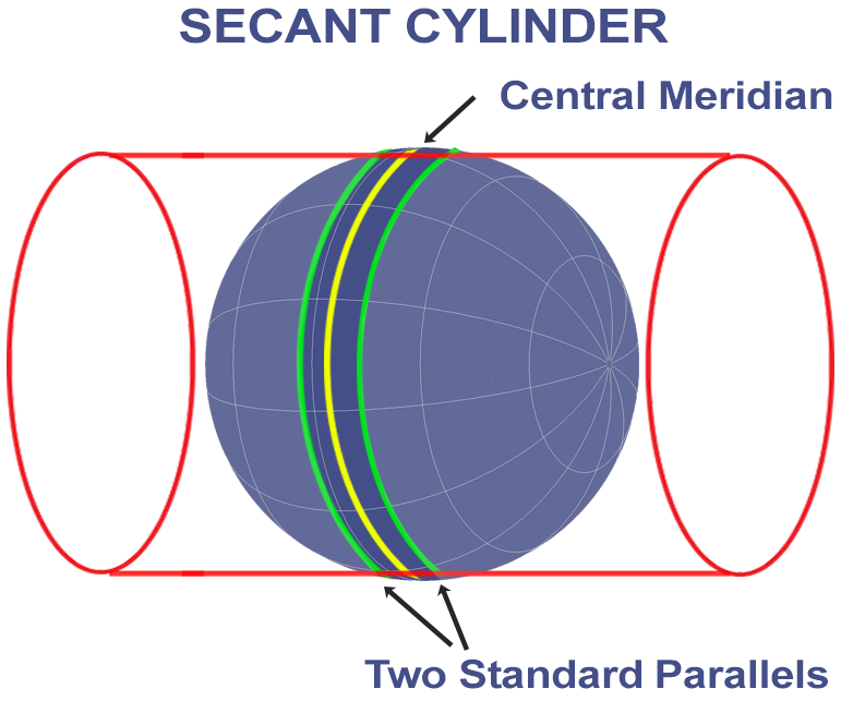
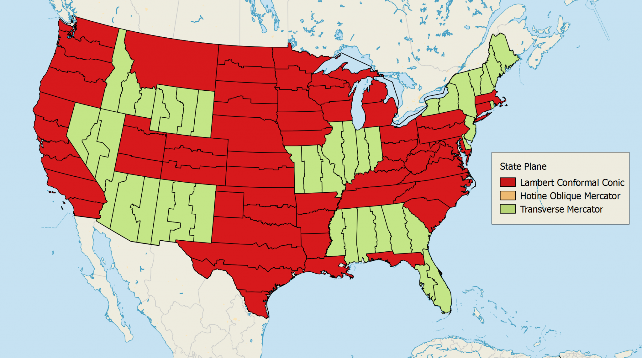
Lambert Conformal Conic Projection
While cartographers use the Lambert Conformal Conic projection for large continents, it's the most common map projection among the SPCS zones.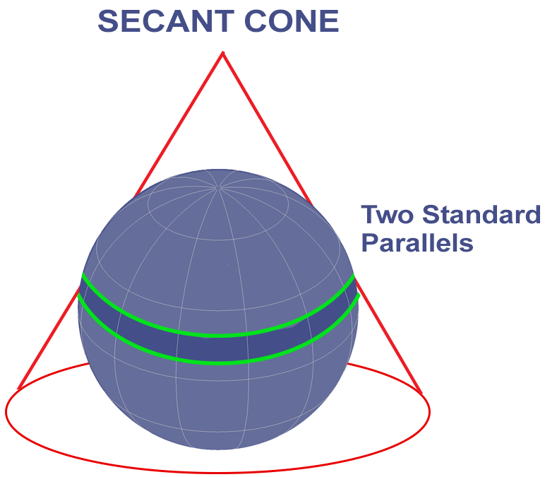
Hotine Oblique Mercator Projection
Finally, the Hotine Oblique Mercator projection is similar to the Transverse Mercator. However, the key difference is how this projection lies at an angle diagonally.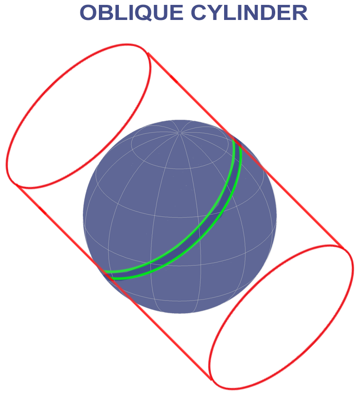
State Plane Coordinate System FIPS Code
Anyone can identify their State Plane Coordinate System zone with a unique FIPS code. For example, Alaska has 10 State Plane Coordinate System zones with a unique FIPS code and map projection.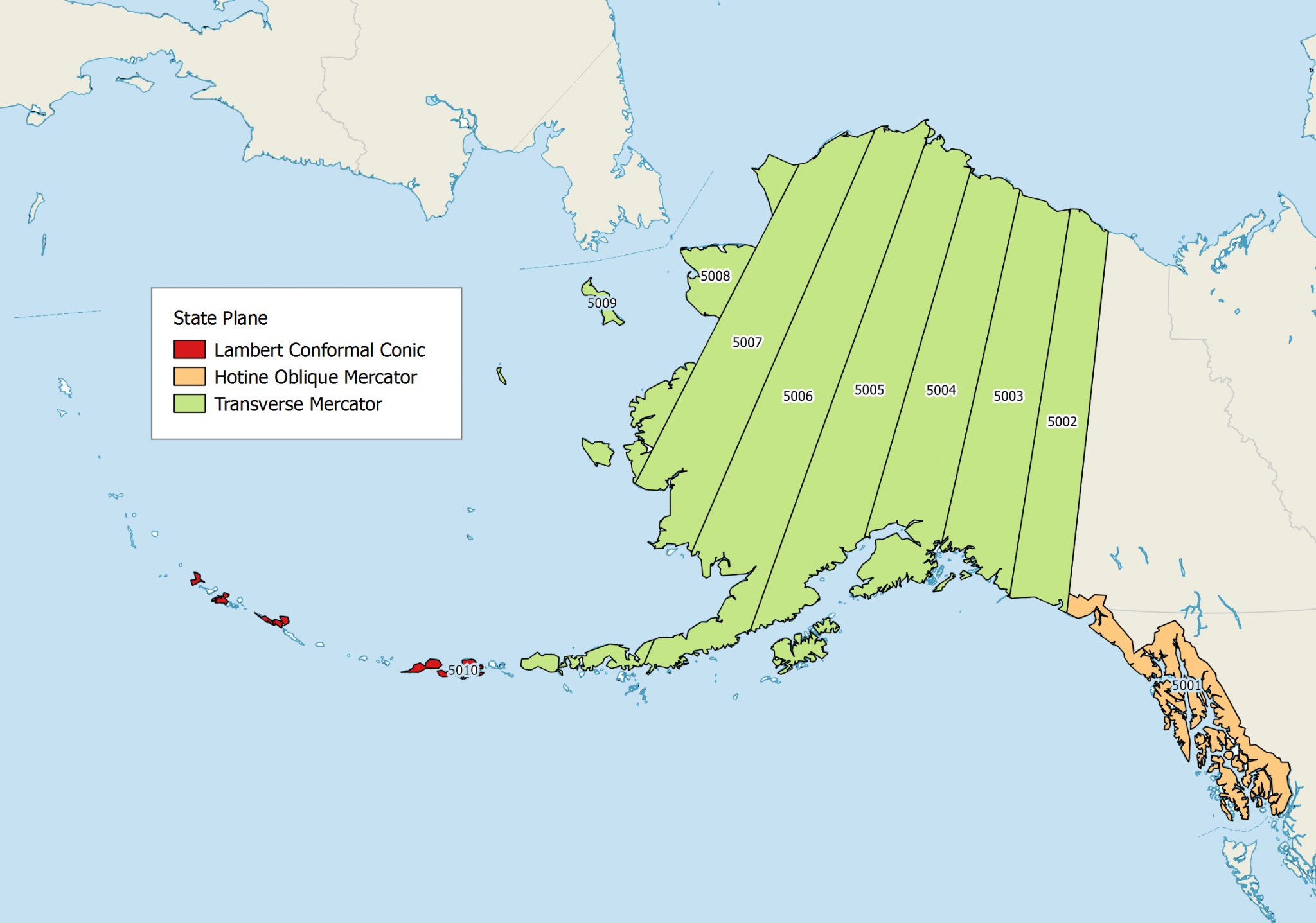
- For FIPS Zone 5001 (Alaska), it uses the Hotine Oblique Mercator
- From FIPS 5002 to 5009 (Alaska), it projects these zones with a Transverse Mercator
- Finally, the Alaska FIPS 5010 zone uses the Lambert Conformal Conic
SPCS 27 and SPCS 83
Over the years, surveyors have significantly improved our understanding of the size and shape of the Earth using geodesy. As a result, the State Plane Coordinate System references both the NAD83 and NAD27 datums.- State Plane Coordinate Systems (SPCS 27) references NAD27 as a standard unit of measure in US survey feet
- State Plane Coordinate Systems (SPCS 83) is based on the NAD83 datum and is commonly measured in meters
State Plane Coordinate System Advantages
Government agencies use the State Plane Coordinate System because each zone has a defined boundary.Counties can manage their data to a common coordinate system with those county and state lines.
Because of the limited distortion due to each zone having its own projection, the SPCS is most suitable for engineering, public works, and surveying applications.
To explore the SPCS in more detail, NOAA's State Plane Coordinate System Manual gives an old-school flavor to its origin.