Which trail would you take?
Imagine. You're out mountain climbing with your friends.You pull out your map and see two hiking trails.
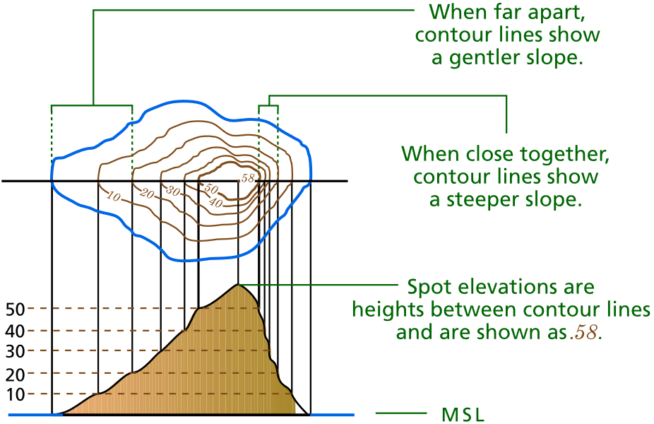
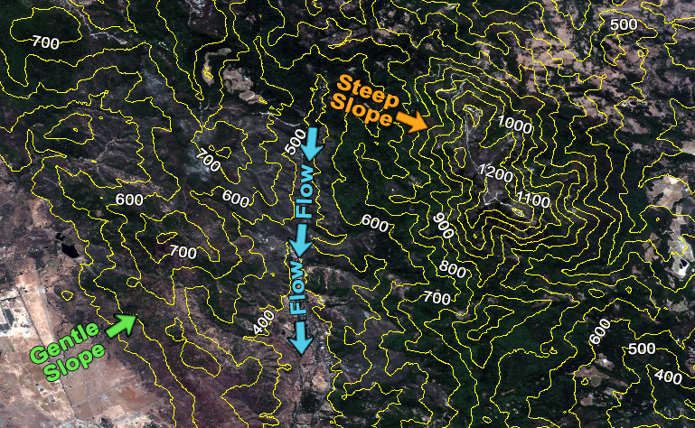
The first route has closely spaced contour lines.
But the second route has widely-spaced spaced contour lines.
Which hiking trail would YOU take?
For the slow-and-steady climber, you'd pick the second route because widely-spaced contour lines mean the slope is gradual. But if you picked the first route, you're the type of free climber who scales mountains with just a pickaxe. This is because when contours are close together, it means that the slope is steeper.
For a quick definition, a contour line joins points of equal and constant values. For example, contours on an elevation have constant heights that are the same on each line in a topographic map.
1. Are there contour lines mountains or depressions?
When you have a closed contour like the one below, this means there is a hill/mountain or depression.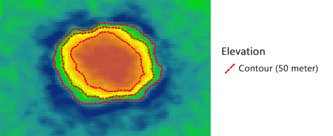

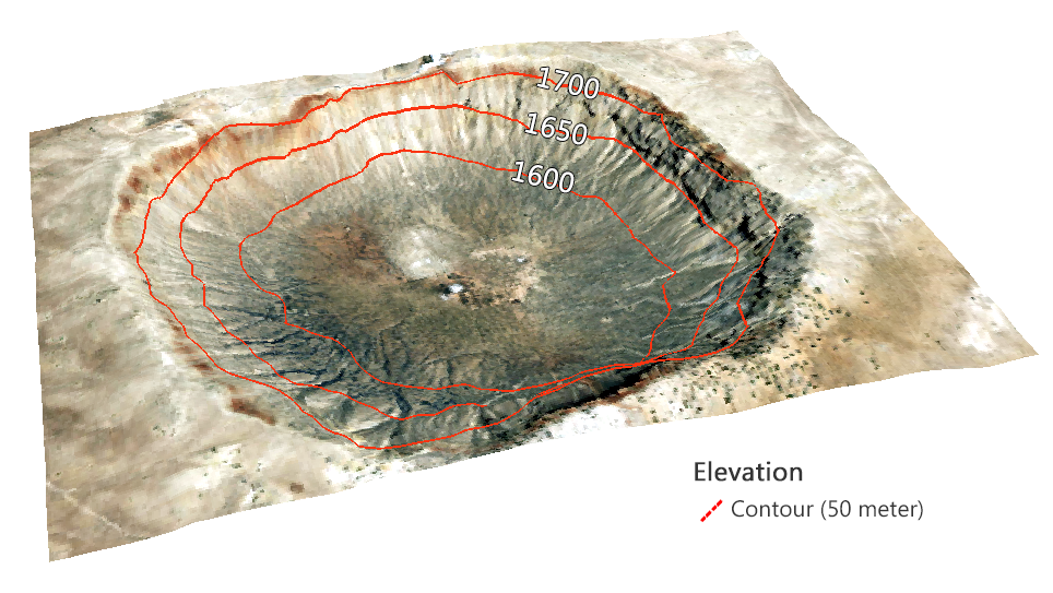
READ MORE: A Topographic Profile of Arizona's Massive Meteor Crater
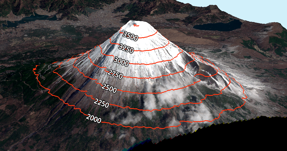
2. What do Mount Fuji's contour lines look like?
In this case, closed contour lines indicate a mountain. The beautiful Mount Fuji stands 3,776 meters tall above sea level. At 250-meter spacing, here's how the contour lines look: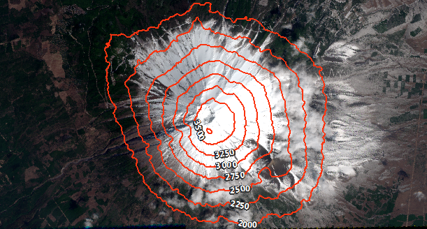
3. The rule of V and U-shaped valleys
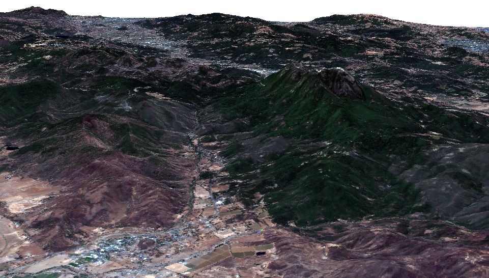
Valleys are elongated low-lying depressions usually with a river flowing through them. You know that you're looking at a valley bottom when contour lines are V or U-shaped.Here is an example of a 3D view of the picturesque Collayomi Valley in California:
At a stream junction, contour lines form an “M” or “W” shape. This can be interpreted as two “V-shaped contours intersecting.
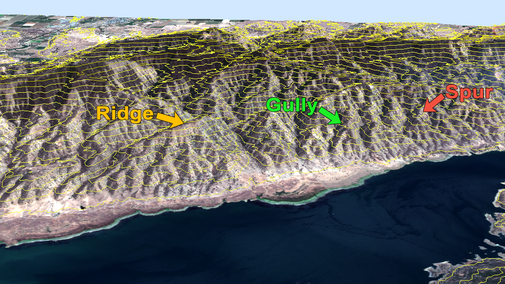
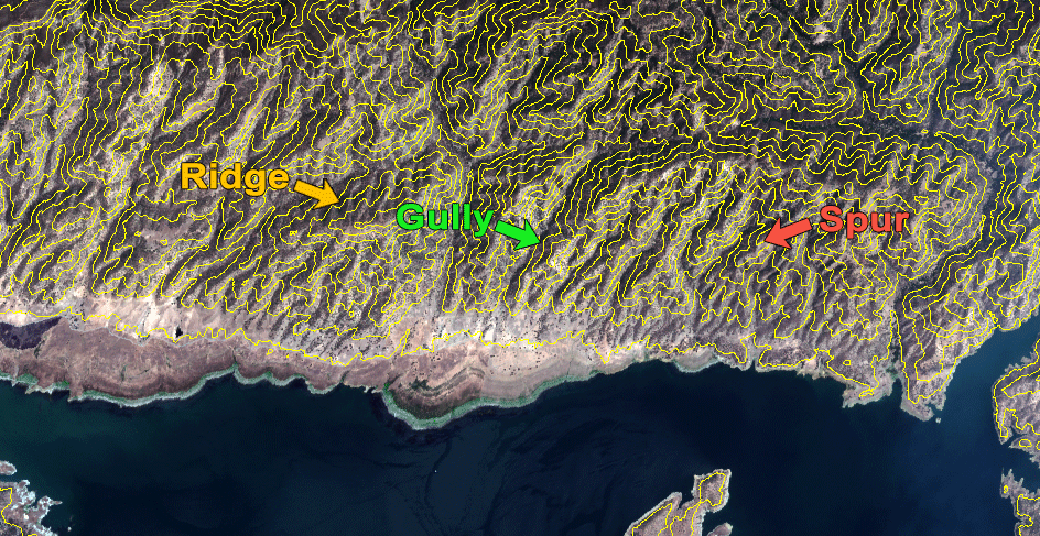
4. What about ridges and gullies?
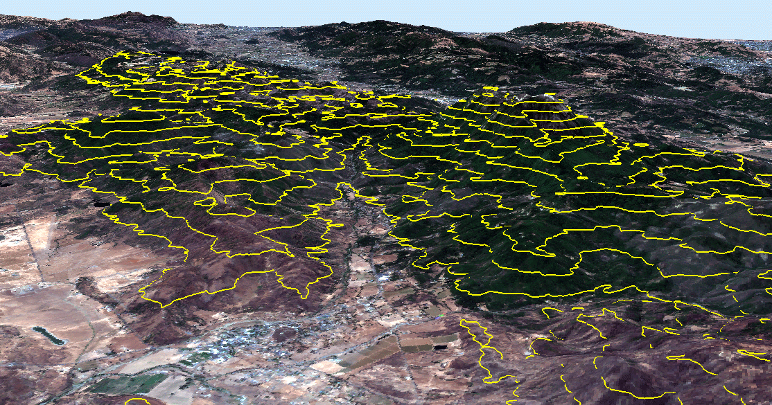
Over time, gullies form through the erosion of running water on hillsides. A consequence of two eroded gullies is a spur at the center on the face of a hillside that sticks out. Both gullies and spurs run from ridgelines to valley bottoms.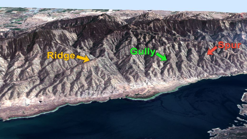
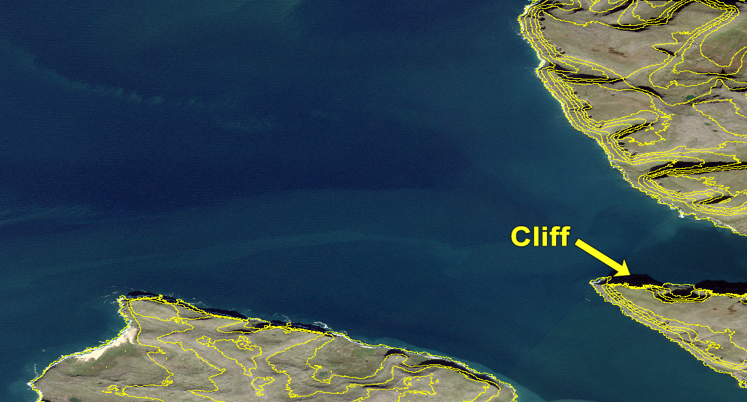
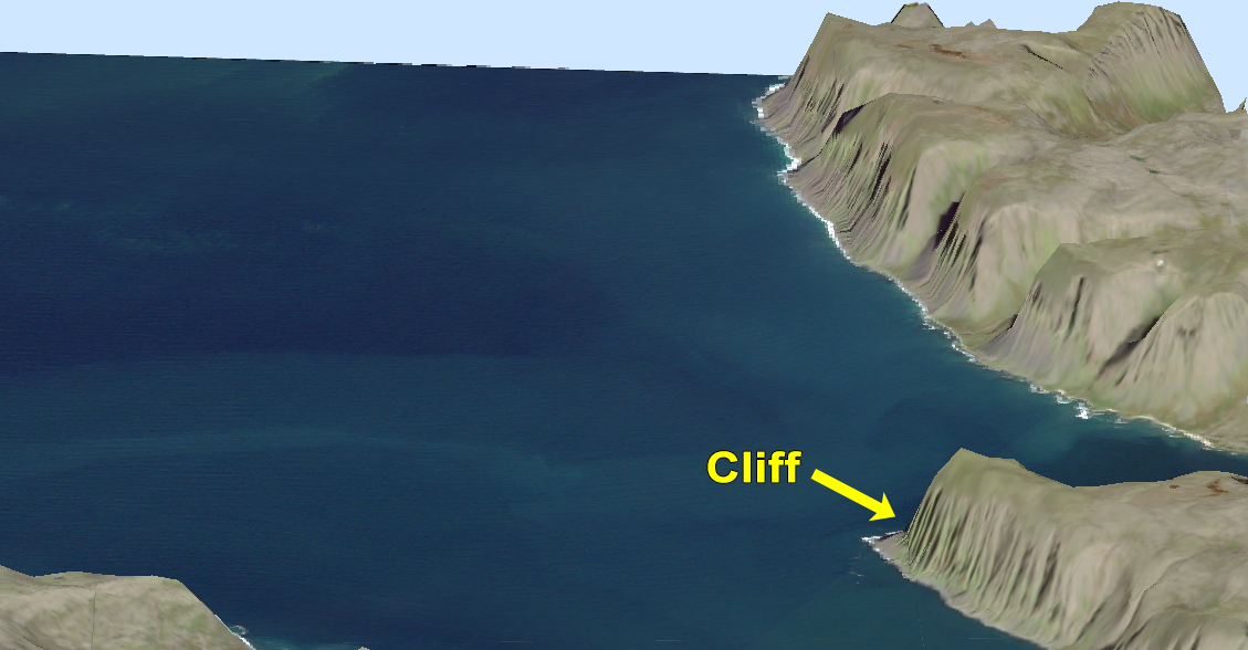
5. Why do contour lines never cross?
It's unlikely that contours cross, but sometimes they do. When the terrain is an overhang or cliff, contour lines will cross or touch.The cliffs in Látrabjarg, Iceland are up to 440 meters tall. When you generate 100-meter contours, they are very close to converging.
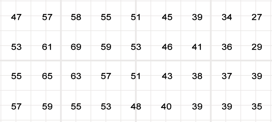
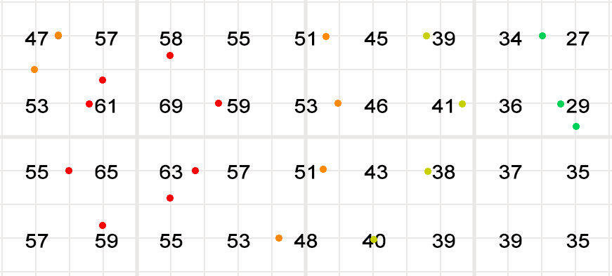
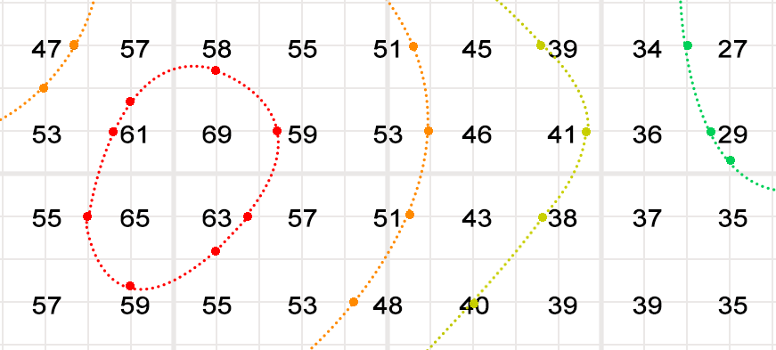
6. How to draw contour lines manually?
You can easily generate contour lines with the click of a button in CAD or GIS software. But what if you want to draw it by hand?First, you have to choose a contour interval. For example, we're going to use a contour interval of 10 meters. So this means that there will be a contour every 10 meters.
7. What do we use contour lines for?
In our example, contour lines represented constant elevation and showed the topography of the landscape.But meteorology (isopleth), magnetism (isogon) and even drive-time (isochrones) also use contours for different purposes.
The closeness of contours indicates slope. Irregular contours mean rugged terrain. It's rare in nature for contours to cross. But they can for overhangs and cliffs.
What are some other types of contours you've seen in nature?