
Latitude, Longitude, and Coordinate System Grids
Here's how you can remember latitude and longitude:Latitude lines run east-west and are parallel to each other but measure north-north. So if you go north, latitude values increase. Finally, latitude values (Y-values) range between -90 and +90 degrees.
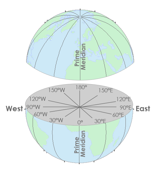
But longitude lines run north-south and measure east-west. They converge at the poles. And its X-coordinates are between -180 and +180 degrees.
Latitude and longitude coordinates make up our geographic coordinate system.
1. Map Coordinate Systems
You can give any location on Earth latitude and longitude coordinates.The field of study that measures the shape and size of the Earth is geodesy. Geodesists use coordinate reference systems such as WGS84, NAD27, and NAD83. In each coordinate system, geodesists use mathematics to give each position on Earth a unique coordinate.
A geographic coordinate system defines two-dimensional coordinates based on the Earth's surface. It has an angular unit of measure, prime meridian, and datum (which contains the spheroid).
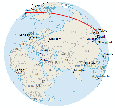
As shown in the image below, lines of longitude have X-coordinates between -180 and +180 degrees.
On the other hand, lines of latitudes have Y-values that are between -90 and +90 degrees.
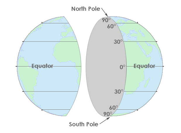
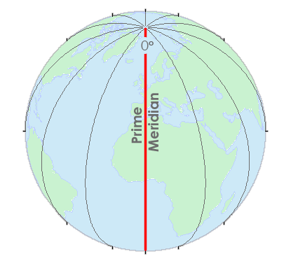
The Greenwich Meridian (or prime meridian) is a zero line of longitude from which we measure east and west. In fact, the zero line passes through the Royal Observatory in Greenwich, England, which is why we call it what it is today. In a geographical coordinate system, the prime meridian is the line that has 0° longitude. Most horizontal datums assign the equator as a zero line of latitude.
The equator is where we measure north and south. Whereas, the Greenwich Meridian (or prime meridian) is a zero line of longitude from which we measure east and west.
Together, these lines provide a reference for latitude and longitude that always zig-zag into each other. This geographic grid gives unique latitude and longitude for every position on Earth.
2. Find Anything on Earth with Coordinates
Coordinates are pairs (X,Y) in a two-dimensional space referenced to a horizontal datum. Whereas triplets (X,Y,Z) of points not only have a position but also has height referenced to a vertical datum. In other words, the X- and Y-values represent a horizontal position. Whereas, the Z-value represents the vertical position.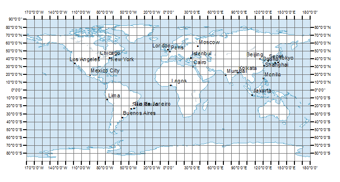
A horizontal datum has a major axis, which is the longest diameter of an ellipse. Also, it has a minor axis, which is the shortest diameter of an ellipse. Finally, a horizontal datum has a radius that represents the position of the surface relative to the center of the earth.
Additionally, time zones roughly use lines of longitude at 15° intervals. Starting at the Prime Meridian, there are 24 different time zones in the world, as shown in the world time zone map.
3. What is a Coordinate Reference System?
A reference ellipsoid is the mathematical model of the shape of the Earth with the major axis along the equatorial radius.A geographic coordinate system uses longitude and latitude expressed in decimal degrees. For example, WGS 1984 and NAD 1983 are the most common datums in use today. Before 1983, NAD27 was the most common datum.
- Latitude: 40 degrees, 42 minutes, 51 seconds N
- Longitude: 74 degrees, 0 minutes, 21 seconds W
You can also express geographic coordinates in decimal degrees. It's just another way to represent that same location in a different format. For example, here is New York City in decimal degrees:
- Latitude: 40.714
- Longitude: -74.006
The Federal Communications Commission has a DMS-Decimal converter tool that converts latitude and longitude between decimal degrees and degrees, minutes, and seconds.
4. Latitude, Longitude, and Spherical Coordinate System Grids
When you put two coordinates together as a pair (X, Y), you can locate anything on Earth.Latitude and longitude form our coordinate system grid.
Also, you can express coordinates in different ways. For example, you can use decimal degrees or degrees-minutes-seconds.
Thanks to our geographic coordinate system, you can pinpoint any point on Earth such as GPS receivers. This includes the spot where you are reading this article right now.
Table of contents
- Latitude, Longitude and Coordinate System Grids
- Where is the Central Meridian?
- Greenwich Meridian (Prime Meridian)
- Lost in Null Island: The Curious Origin of 0,0
- Degrees/Minutes/Seconds (DMS) vs Decimal Degrees (DD)
- What is a Horizontal Datum Reference Frame?
- Vertical Datum – Earth's Elevation Reference Frame