
50 Map Projections Types
If you’re in need of a visual reference guide to the various map projection types… Then, look no further.Because we’ve pumped out a goldmine of the top 50 global map projections used by cartographers today.
From Aitoff to Winkel, these map projections are your blueprint for designing cartographic masterpieces.
Because it’s all about the audience… Let’s map with authority and dig right into the BIG LIST of map projections.
A Visual Reference Guide
Scroll down to see all 50 map projection examples. What’s your favorite? Which ones have you used in your maps?1. Aitoff

2. Azimuthal Equidistant

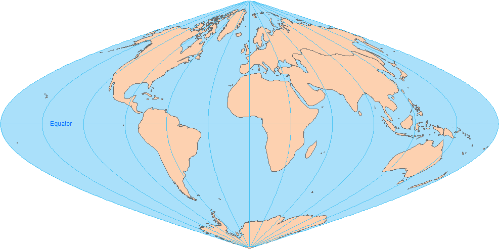
3. Behrmann
4. Berghaus Star AAG

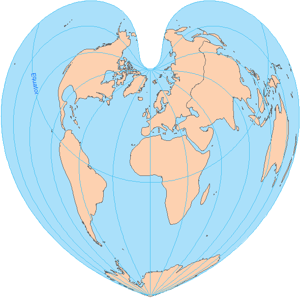
5. Bonne
6. Cassini

7. Compact Miller

8. Craster Parabolic

9. Cube

10. Cylindrical Equal Area

11. Eckert-1

12. Eckert-2

13. Eckert-3

14. Equidistant Conic

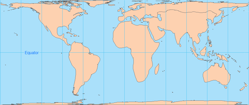
15. Equidistant Cylindrical

16. Equidistant Cylindrical ARC System

17. Flat Polar Quartic

18. Fuller

19. Gall Stereographic

20. Goode Homolosine Land

21. Goode Homolosine Ocean

22. Hammer Aitoff
23. Hotine

24. Loximuthal

25. Mercator

26. Miller Cylindrical

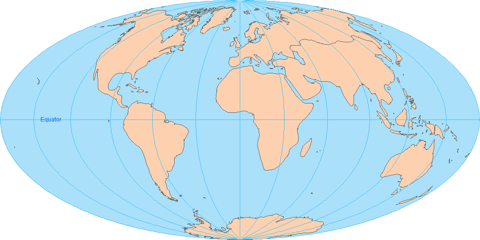
27. Mollweide
28. Natural Earth

29. North Pole Gnomonic

30. North Pole Lambert Azimuthal Equal Area

31. North Pole Orthographic

32. NSIDC EASE Grid Global

33. Patterson

34. Plate Caree

35. Polyconic

36. Quartic Authalic

37. Robinson

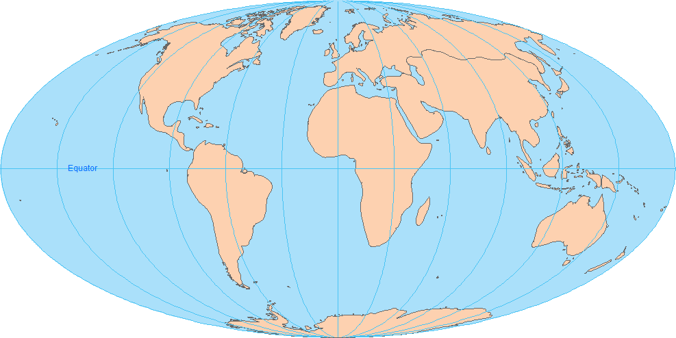
38. Sinusoidal
39. South Pole Azimuthal Equidistant

40. South Pole Stereographic

41. Earth from Space

42. Stereographic

43. Times

44. Two-point Equidistant

45. Van der Grinten

46. Vertical Perspective

47. Wagner

48. Wagner-2

49. Winkel-1

50. Winkel Tripel

Types of Map Projections
Now that you have an arsenal of map projections, it’s time to put what you know into action.Take a fresh approach to your next map…
Because there’s nothing quite like creating a work of art.
So which map projection suits your needs most?
Table of contents
- How Map Projections Work?
- Map Distortion with Tissot’s Indicatrix
- Cylindrical Projection: Mercator, Miller and Pseudocylindrical
- Conic Projection: Lambert, Albers and Polyconic
- Azimuthal Projection: Orthographic, Stereographic and Gnomonic
- Equal Area Projection Maps
- What Is the Web Mercator Projection?
- How Universal Transverse Mercator (UTM) Works
- 50 Map Projections Types: A Visual Guide